Platforms: ERS-1
From
| (9 intermediate revisions not shown) | |||
| Line 7: | Line 7: | ||
== Спутник == | == Спутник == | ||
{| | {| | ||
| - | |[[File:ers1.jpg]] | + | |[[File:ers1.jpg|thumb|400px]] |
| | | | ||
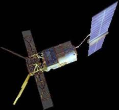
The satellite concept is based on the re-utilisation of the Multi-mission Platform, developed within the French SPOT programme. This platform provides the major services for the satellite and payload operation, in particular attitude and orbit control, power supply, monitoring and control of payload status, telecommunications with the ground segment. | The satellite concept is based on the re-utilisation of the Multi-mission Platform, developed within the French SPOT programme. This platform provides the major services for the satellite and payload operation, in particular attitude and orbit control, power supply, monitoring and control of payload status, telecommunications with the ground segment. | ||
| Line 14: | Line 14: | ||
== Результат == | == Результат == | ||
{| | {| | ||
| - | |[[File:MediterreneanSea.gif]] | + | |[[File:MediterreneanSea.gif|thumb|600px]] |
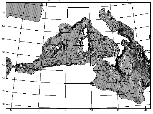
| Mediterranean Sea. The altimetric marine gravity field from the combined ERS-1 and GEOSAT geodetic missions. | | Mediterranean Sea. The altimetric marine gravity field from the combined ERS-1 and GEOSAT geodetic missions. | ||
|- | |- | ||
| - | |[[File:ers1Instrument.jpg]] | + | |[[File:ers1Instrument.jpg|thumb]] |
| | | | ||
|} | |} | ||
Latest revision as of 12:14, 3 December 2012
ERS (European Remote Sensing Satellite) are a family of multi-disciplinary Earth Observation Satellites.
Cпутник дистанционного зондирования Земли, произведённый Европейским космическим агентством и предназначенный для осуществления высокоточных измерений при наблюдении за поверхностью Земли и её атмосферой. Аппарат был запущен 17 июля 1991 года с космодрома Куру во Французской Гвиане. Не смотря на расчётный срок службы, спутник прослужил 9 лет и за время своего существования передал более 1,5 миллионов изображений (при помощи радара SAR). ERS-1 завершил свою работу 10 марта 2000 года в связи с отказом бортовой системы ориентации. Полученные данные позволили обнаружить рядом с антарктической станцией «Восток» вытянутое плато с аномально малым перепадом высот. Это плато было проинтерпретировано как большое подлёдное озеро, получившее название Восток.
Спутник
|
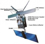
The satellite concept is based on the re-utilisation of the Multi-mission Platform, developed within the French SPOT programme. This platform provides the major services for the satellite and payload operation, in particular attitude and orbit control, power supply, monitoring and control of payload status, telecommunications with the ground segment. To meets its mission objectives, ERS-1 has been placed in a near-polar orbit at a mean altitude of about 780 km with an instrument payload comprising active and passive microwave sensors and a thermal infra-red radiometer. The satellite is large, weighing 2400 kg and measuring 12 m x 12 m x 2.5 m, making it the largest and most sophisticated free-flying satellite built so far in Europe. |
Результат
| Mediterranean Sea. The altimetric marine gravity field from the combined ERS-1 and GEOSAT geodetic missions. | |
Источники
Описание: http://www.wikipedia.org/wiki/ERS-1, http://earth.esa.int/ers/satconc/
Изображения: http://space.skyrocket.de/doc_sdat/ers-1.htm, http://www.fas.org/irp/imint/docs/rst/Intro/Part2_25.html


