Platforms: Cryosat-2
From
| Line 13: | Line 13: | ||
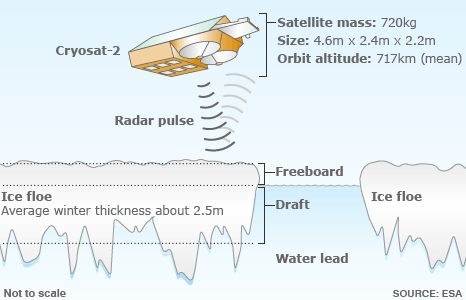
| Cryosat's radar has the resolution to see the Arctic's floes and leads<br>Some 7/8ths of the ice tends to sit below the waterline - the draft<br>The aim is to measure the freeboard - the ice part above the waterline<br>Knowing this 1/8th figure allows Cryosat to work out sea ice thickness | | Cryosat's radar has the resolution to see the Arctic's floes and leads<br>Some 7/8ths of the ice tends to sit below the waterline - the draft<br>The aim is to measure the freeboard - the ice part above the waterline<br>Knowing this 1/8th figure allows Cryosat to work out sea ice thickness | ||
|- | |- | ||
| - | |[[File:]] | + | |[[File:GravityField.jpg]] |
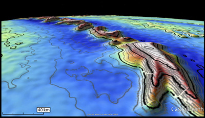
| - | | | + | | But CryoSat’s radar altimeter can sense the gravity field at the ocean surface, so that seafloor characteristics at scales of 5–10 km are revealed. This is the first altimeter in 15 years to map the global marine gravity field at such a high spatial resolution. |
|} | |} | ||
Revision as of 10:29, 3 December 2012
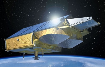
Спутник CryoSat-2 был запущен 9 апреля 2010 года с космодрома Байконур при помощи ракеты-носителя "Днепр-1". Искусственный спутник Земли Европейского космического агентства (ЕКА), предназначенный для измерения толщины и площади ледового покрова Антарктиды, Гренландии, Исландии, высокоширотных океанских зон, а также горных ледников при помощи высокоточного высотомера, способного работать в трех режимах. Спутник должен отслеживать динамику изменения ледников и прояснить вопрос о влиянии на них глобального потепления. Создан в рамках программы ЕКА «Живая планета». CrioSat-2 также предназначен для наблюдения за воздействием глобального потепления на полярные льды. Разработка спутника началась в 2002. 8 октября 2005 года спутник Криосат-1 был потерян в момент выведения из-за аварии ракеты «Рокот». 26 февраля 2006 ЕКА объявила, что спутник будет создан заново.
Спутник
Результат
Источники
Описание: http://www.wikipedia.org/wiki/Криосат-2, http://www.ria.ru/science/20120528/659355789.html
Изображения: ESA / AOES Medialab, http://www.esa.int


