Platforms: QUIKSCAT
From
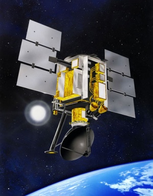
QuikSCAT mission is intended to record sea-surface wind speed and direction data under all weather and cloud conditions over Earth's oceans. QuikSCAT was initiated as a "quick recovery" mission to help reduce the ocean-wind vector data gap created by the loss of the NASA Scatterometer (NSCAT) on the Japanese Advanced Earth Observing Satellite (ADEOS), which ceased functioning when ADEOS failed on June 30, 1997. QuikSCT launched in June 19, 1999, QuikSCAT was designed to be a “quick recovery” EOS satellite mission to fill the gap of global ocean surface wind vector observations. The SeaWinds scatterometer on QuikSCAT began producing science quality data on July 19, 1999. Since QuikSCAT’s launch, the SeaWinds instrument has continued to provide the same high quality data covering more than 90% of the ice-free oceans every day for more than 10 years. QuikSCAT operates in a near polar orbit. It flies in a circular orbit at an altitude of approximately 800 km (500 miles) above Earth's surface. It completes a full orbit in about 101 minutes, which translates to a little more than 14 orbits per day. QuikSCAT has a repeat period of approximately 4 days/57 orbits and the local equator crossing time at the ascending node is 6 hours +/- 30 minutes. The orbit period is approximately 101 minutes. QuikSCAT flies at a mean altitude of approximately 802.4 km and has an orbit inclination of 98.616°. The operational mission duration was intended for up to 3 years.
Спутник
|
Instrument: |
Результат
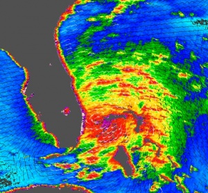
| Tropical Storm Katrina is shown here as observed by NASA’s QuikSCAT satellite on August 25, 2005, at 08:37 UTC (4:37 a.m. in Florida). At this time, the storm had 80 kilometers per hour (50 miles per hour; 43 knots) sustained winds. The storm does not appear to yet have reached hurricane strength. | |
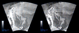
| An international research team using data from NASA's SeaWinds instrument aboard the Quick Scatterometer spacecraft has detected the earliest yet recorded pre-summer melting event in a section of Antarctica's Larsen Ice Shelf. This huge, nearly 200 meter (656 foot) thick plate of glacier-fed floating ice, which in the late 1980s was about as large as Indiana, experienced dramatic disintegration events beginning in 1995 that have reduced its area by nearly 10 percent, or more than two trillion tons of ice. |
Источники
Описание: http://podaac.jpl.nasa.gov/OceanWind/QuikSCAT
Изображения: http://www.nasa.gov/vision/earth/lookingatearth/h2005_katrina-quikscat-082505.html, http://www.jpl.nasa.gov/news/news.php?release=2003-004


