Platforms: OSTM/Jason-2
From
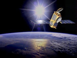
The Ocean Surface Topography Mission (OSTM) is a joint effort by four organizations to measure sea surface height by using a radar altimeter mounted on a low-earth orbiting satellite called Jason-2. The Jason-2 satellite mission launched successfully on June 20, 2008. The OSTM operations are planned for 5 years, comprising the Routine Operations (3 years) and the Extended Routine Operations Phases (2 years). This satellite altimetry mission provides sea surface heights for determining ocean circulation, climate change and sea-level rise. The Jason-2 satellite is the follow-on to the TOPEX/POSEIDON and Jason-1 satellites. The research satellites, TOPEX/POSEIDON and Jason-1, have been instrumental in meeting NOAA’s operational need for sea surface height measurements necessary for ocean modeling, forecasting El Nino/La Nina events, and hurricane intensity prediction. Under the OSTM program NOAA will provide support from its satellite ground segment capabilities for management of the Jason-2 Satellite flight operations during its routine operational phases and to acquire, produce, and distribute geophysical data in a manner beneficial to all interested users.
Спутник
|
Scientific Instruments
|
Результат
|
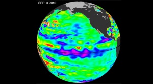
Growing La Nina. |
|
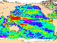
| OSTM/Jason 2 map of sea-level anomalies from July 4 to July 14, 2008. |
Источники
Описание: http://www.osd.noaa.gov/ostm/
Изображения: http://www.jpl.nasa.gov/missions/details.php?id=5927, http://www.nasa.gov/topics/earth/features/lanina-image2010091.html


